Geological Marvel of the Colorado Plateau
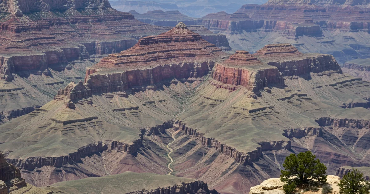
Plunging over a mile (1,800 meters) deep, up to 18 miles (29 kilometers) wide, and stretching 277 miles (446 kilometers) long, the Grand Canyon is an unparalleled geological catalog. Its complex labyrinth of horizontal multi-colored rock strata preserves an intact chronological record of geological shifts spanning nearly two billion years, from the ancient Vishnu Schist at its base to the younger Kaibab Limestone at its rim. This immense chasm showcases a remarkable cross-section of Earth's history, revealing layers of sedimentary, metamorphic, and igneous rocks.
The Grand Canyon's formation is primarily attributed to the erosional power of the Colorado River, which has incised through the uplifted Colorado Plateau over millions of years, continuing to shape the landscape today. This vast elevation gradient supports a diverse array of ecosystems, ranging from desert scrub at the canyon floor to coniferous forests on the rims, harboring unique flora and fauna. The canyon also holds profound cultural and spiritual significance for several Native American tribes, who have inhabited the region for thousands of years, leaving behind archaeological sites and a rich heritage.
Attributes
| Year Inscribed | 1979 |
|---|---|
| Property Area | 492608 ha |
| Buffer Zone | 0 ha |
| UNESCO ID | 75 |
| Category Type | Natural |
| Primary Material | Stratified Sedimentary Rock |
| Epoch Origin | Precambrian to Paleozoic Strata |
| Conservation Status | Excellent |
| Annual Visitors | 5 million |